Posts

weather

Brace for a Dramatic Forecast Shift: Record Heat in the West, Winter’s Return in the East

A sharp and unusual shift in weather patterns is set to sweep across the United States, bringing a striking split of an intense, record-breaking heat in the West and a renewed blast of winter in the East.

The change is being driven by a powerful atmospheric setup that will likely persist for up to two weeks. A strong ridge of high pressure, often called a “heat dome,” is expected to settle over the western half of the country, allowing temperatures to surge well above seasonal norms. At the same time, the jet stream will dip southward on the eastern side of that ridge, funneling cold Canadian air into the Midwest and East.

The result will be a pronounced case of weather whiplash. Areas that recently experienced springlike warmth will soon return to much colder conditions, with the possibility of additional snowfall through mid-to-late March.

Cities that climbed into the 70s and 80s earlier this week are expected to cool dramatically, with highs dropping into the 30s and 40s. Washington, DC, for example, reached 84 degrees on Tuesday but is forecast to fall into the 50s over the weekend and into the 40s early next week. Parts of the Northeast, which also saw temperatures in the 70s, could face multiple chances for snow over the next five to seven days.

The chill may extend as far south as Florida, where some areas could see overnight lows in the 50s this weekend, with a further drop into the 40s early next week. While the East braces for a late-season cold snap, the situation in the West is expected to be far more extreme and potentially dangerous.

Embed from Getty Images

Forecasters say the heat wave will dominate headlines beginning Thursday and could persist for at least two weeks. Numerous locations across the region are likely to challenge or break all-time March temperature records.

The National Weather Service has issued warnings, particularly for the Southwest, urging residents to prepare for unusually intense and long-lasting heat. In Phoenix, temperatures could reach 100 degrees, the earliest ever recorded, more than 10 days ahead of the current record.

“Given the unprecedented length and magnitude of this extreme heat wave, heat stress will be increasing each day.”

Extreme heat is the leading weather-related cause of death in the contiguous United States each year, underscoring the risks posed by early-season temperature spikes.

Beyond the immediate dangers, the heat wave is expected to worsen already concerning environmental conditions. Snowpack across the West is significantly below average, and the surge in temperatures will accelerate melting, raising alarms about water availability later in the year and the potential for an intense wildfire season.

Embed from Getty Images

Speaking about the West, University of California climate scientist Daniel Swain stated the outlook for snowpack is especially dire in states like Colorado and Utah, which are on track to set record lows.

“We’re going to get to April first, and we’re going to see some very scary snowpack numbers essentially everywhere.”

Southern California, in particular, could see temperatures soaring 20 to 30 degrees above average during the next two weeks, according to the National Weather Service.

This event comes on the heels of an already exceptional season. The West just experienced its warmest meteorological winter on record, with several states setting all-time highs for winter temperatures.

Scientists note that climate change is increasing the likelihood, duration, and intensity of heat waves and is likely contributing to the region’s record-breaking winter warmth.

Seasonal patterns themselves are also shifting. Winter is warming faster than any other season across much of the United States, and spring is arriving earlier in many regions, with the final freeze occurring sooner than in the past.

For now, however, the immediate story is of a country divided between early-summer heat and a lingering grip of winter, all unfolding at once.

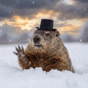
Punxsutawney Phil

Punxsutawney Phil Sees His Shadow, Predicts Six More Weeks of Winter

For the 20th time since 2000, Punxsutawney Phil has delivered a familiar forecast: winter isn’t ready to loosen its grip. The world’s most famous groundhog emerged early Sunday morning at Gobbler’s Knob in Punxsutawney, Pennsylvania, where he saw his shadow — a sign, according to tradition, that six more weeks of winter lie ahead.

Temperatures hovered just above zero as tens of thousands of spectators gathered for the annual Groundhog Day ritual. Despite the bitter cold, longtime attendees said the celebration offered a welcome break from winter monotony.

Rick Siger, Pennsylvania’s secretary of community and economic development, said the thermometer in his vehicle read 4 degrees Fahrenheit as he drove to Gobbler’s Knob. Still, he returned for his fourth consecutive Groundhog Day.

“I think it’s just fun — folks having a good time. It brings people together at a challenging time. It is a unifying force that showcases the best of Pennsylvania, the best of Punxsutawney, this area.”

Nearby, Lisa Gibson marked her 10th Groundhog Day bundled up in a lighted hat designed to resemble the tree stump from which Phil appears each year at dawn. She attended with her husband, who was dressed as Elvis Presley, and their teenage daughter.

“Oh man, it just breaks up the doldrums of winter,” Gibson said. “It’s like Halloween and New Year’s Eve all wrapped up into one holiday.”

The Pittsburgh resident said she had been hoping Phil wouldn’t see his shadow. The forecast was met with loud boos from the crowd. Phil’s handlers cut short the customary post-prediction photo opportunities, citing the extreme cold and concerns about keeping the animal exposed for too long.

Embed from Getty Images

Despite his celebrity status, Phil is far from the most reliable weather forecaster. In 2025, the National Oceanic and Atmospheric Administration evaluated 19 animal-based prognosticators, including live animals, taxidermized figures, and even statues, and ranked their accuracy.

Staten Island Chuck claimed the top spot with an 85% accuracy rate. Phil ranked 17th, with a success rate of just 35%.

This year’s predictions from other animal forecasters were split:

  • Staten Island Chuck (New York): six more weeks of winter
  • Woodstock Willie (Illinois): early spring
  • Dunkirk Dave (New York): early spring
  • Buffalo Bert (New York): six more weeks of winter
  • General Beauregard “Beau” Lee (Georgia): six more weeks of winter
  • Woody the Woodchuck (Michigan): six more weeks of winter

On Sunday, Phil reportedly selected one of two scrolls confirming the extended winter prediction.

Phil’s forecast hinges on a simple rule. If the sun is shining and he sees his shadow, the Punxsutawney Groundhog Club says it signals “an omen of six more weeks of bad weather,” prompting him to return to his burrow. If clouds obscure the sun and no shadow appears, Phil stays above ground, signaling an early spring.

The shadow-based ritual traces back centuries to Candlemas, a Christian holiday observed on Feb. 2 that marks the midpoint between winter and spring. Candlemas commemorates the presentation of Jesus at the Temple of Jerusalem and traditionally involves blessing candles for use throughout the year.

Historically, the weather on Candlemas was believed to predict the coming season. An old English rhyme reflects that belief. “If Candlemas be fair and bright, winter has another flight. If Candlemas brings clouds and rain, winter will not come again,” it reads.

Before groundhogs entered the picture, Europeans observed other hibernating animals, such as bears and badgers, to predict seasonal change, according to the National Weather Service.

When German immigrants settled in Pennsylvania in the 1700s, they brought their Candlemas customs with them. Lacking native badgers, they turned to groundhogs instead, cementing the animal’s role in American folklore.

Embed from Getty Images

The modern celebration began in the late 19th century. Clymer Freas, editor of the Punxsutawney Spirit and a member of the Punxsutawney Groundhog Club, originally a groundhog hunting group, published an article in 1886 claiming a local groundhog could predict the weather.

The first official trip to Gobbler’s Knob followed on Feb. 2, 1887, when Phil saw his shadow. The tradition gained global fame decades later with the release of the 1993 film “Groundhog Day,” starring Bill Murray. Today, Phil is promoted as the “Seer of Seers,” drawing visitors from around the world each February.

As the crowd gathered this year, People for the Ethical Treatment of Animals (PETA) renewed its push to replace Phil with a hologram.

In a Jan. 20 letter to Punxsutawney Groundhog Club President Tom Dunkel, PETA founder Ingrid Newkirk argued that groundhogs are timid animals that prefer not to be around noisy crowds.

“As we’ve pointed out before, it’s time to chuck this tired tradition. Groundhogs are timid prey animals who, if they’re able to, actively avoid humans. They dislike human smells, fear loud noises, abhor gatherings, and prefer to stay in their burrows. Yet every year, this terrified little animal is subjected to loud announcers and noisy crowds and held up and waved around without any regard for his feelings, welfare, or instincts.”

PETA proposed retiring Phil and his family to a sanctuary in exchange for “a massive, state-of-the-art, 3-D projection of a groundhog complete with vocal weather predictions to light up the stage at Gobbler’s Knob each year.” The animal rights organization argued the town could “still make a quick buck out of Chuck.”

“A giant 3-D hologram would thrill crowds and illuminate the fact that compassion and innovation go hand in hand. Punxsutawney could at last show that genuinely caring for Phil means letting him hibernate, dig, burrow, smell fresh air, and simply live like the wild animal he is in a reputable sanctuary.”

Pennsylvania Gov. Josh Shapiro dismissed the idea in a post on X, sharing a photo of Phil alongside the caption “Don’t tread on me,” a reference to the Revolutionary War–era Gadsden Flag.

The nonprofit has made similar appeals before. In 2025, it suggested replacing Phil with a vegan “Weather Reveal” cake, sliced open to reveal blue for six more weeks of winter or pink for an early spring. For now, though, the forecast and the forecaster remain unchanged.

tornado

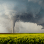
Major Tornado Outbreaks Throughout US Leave Many States At Risk For Extreme Flooding

A major tornado outbreak across the US has led to a rare and widespread flooding threat throughout the midwest and South this week, according to weather forecasting experts. The experts are emphasizing just how “prolific” and “historic” these weather events are as a means of also highlighting the shortage of forecasting and disaster response efforts across the country. 

Embed from Getty Images

Around 100 tornadoes impacted various parts of the US on Wednesday alone, and at least four people have died as a result of this extreme weather. 

The National Weather Service (NWS) stated that they were short-staffed while issuing a nearly record-breaking number of tornado warnings for one single day. They issued 284 tornado outbreaks for Wednesday. The only other major weather event to hit that level of intensity occurred in April 2011. 

The warnings stretched across nearly 1,000 miles from Arkansas to Michigan, according to reports

 The cold front that prompted the multitude of tornadoes this week will slow down over the next few days, however, as it slows the threat of thunderstorms near some of the US’s major rivers will create “life-threatening, catastrophic, and potentially historic flash flood event”, according to the NWS.

Memphis, Tennessee is specifically preparing to see flooding up to 12 inches over the next three days. “Communities in the region should prepare for possible long duration and severe disruptions to daily life,”  a NWS forecast bulletin said.  

Embed from Getty Images

The flooding expected to occur across the US is in the same areas that were just impacted by the tornadoes, leaving many communities vulnerable more than once within the same week. At an NWS office in Kentucky, a tornado-producing thunderstorm severely damaged the property while they’re dealing with non-functioning restrooms. 

“They have worked multiple tornado events this spring already and their office doesn’t even have functioning toilets!” wrote a NWS employee.

The Federal Emergency Management Agency recently fired hundreds of its probationary staff after they were ordered too by President Donald Trump and the White House. 

Rural regions in states like Arkansas, Missouri, Tennessee, Kentucky, and Illinois are expected to struggle greatly after the storms pass due to staffing issues and a removal of resources. 

Additionally, the nationwide network of River Forecast Centers has stated that they’ve also been greatly affected by staffing cuts. These weakened agencies are doing everything they can to help the many Americans being impacted by extreme weather events, but their resources are dwindling.

wave

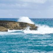
California Citizens Encouraged To Avoid The Ocean As Large Waves Expected To Impact Shorelines 

California residents are currently being urged to avoid shorelines and structures such as wharves and piers as 20 to 30 foot waves are expected to impact the northern Pacific coast throughout the rest of the week and into the New Year. 

The National Weather Service advisory came after the wharf in Santa Cruz experienced a 150 foot section collapsing from high waves earlier this week. Debris from multiple storms are also being blamed for the death of a resident in Santa Cruz county. 

The coast guard in southern California announced that it has suspended the search for two men who went missing after a fishing trip off the coast of Palos Verdes, NBC Los Angeles reported. They also suspended the search after finding wreckage from a boat that was believed to belong to the fishermen. 

“Inexperienced swimmers should stay out of the water due to life-threatening surf conditions. Never turn your back on the ocean,” the NWS warned in the Bay Area.

Embed from Getty Images

High surf and rip currents are being reported throughout the Los Angeles area. 

Santa Cruz also experiences three city workers falling into the ocean when a large section of a pier they were working on collapsed and floated away during a high surf this week. Luckily the workers survived with minor injuries. 

“Nearly 20 miles to the south, at Sunset State beach, California state parks and fire crews responded at around 11.30am on Monday about a man trapped under debris. The man was pronounced dead at a local hospital,” a spokesperson for the Santa Cruz county sheriff’s office said. 

“It’s total chaos. I just did a drive through the south side of town and the beaches are all tore up. It looks like a bomb went off,”  a Santa Cruz resident told the Los Angeles Times.

flood

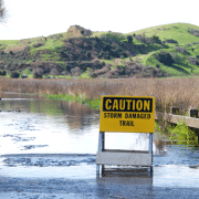
Nearly Entire Population Of California Remains Under Flood Alerts 

Currently almost the entire population of California remains under flood alerts as the state has experienced major rain storms within the past few weeks with more on the horizon. Officials are urging people to try to stay off the roads in the early days of this week, according to reports

Southern California is still recovering from a large storm that had some areas see record-breaking rainfall and hundreds of dangerous mudslides. The storm’s forecasted for this week aren’t projected to be that severe, however, parts of California could see up to 5 inches of rain, and currently 37 million residents are under flood watches, according to CNN

The National Weather Service office in Los Angeles warned of flooding and a possibility of 2 to 5 inches of rain, with up to 10 inches expected in other areas such as Santa Lucias. The office posted online to “avoid flooded roadways and prepare your property for flooding.” 

The office also warned of mud or rock slides on canyon roads as well as an increased presence of debris in areas recently overwhelmed by wildfires. 

“Multiple rounds of moderate to heavy showers, and perhaps a couple of thunderstorms, are expected to affect the region from this evening through Wednesday morning.”

Embed from Getty Images

Central California saw the first round of rain late Saturday afternoon with a second storm on Sunday moving more slowly. At one point this weekend, around 38 million people were under a flood watch. 

State Governor Gavin Newsom’s office announced on Sunday in a news release that they’ve activated the state’s operations center. 

“Our state is taking this next storm seriously, and we ask all Californians to take steps now to prepare.”

The Weather Prediction Center has issued excessive rain outlooks through Tuesday for many parts of both California and Nevada. Santa Barbara is currently at a Level 3 of 4 risk through the rest of the day, and Los Angeles is currently at a Level 2. 

For areas at higher elevations, the National Weather Service in Sacramento also warned of winter storms, effective through Wednesday morning. 

“Heaviest snowfall will be tonight into Monday morning. Sierra travel will be difficult with possible road closures, chain controls and reduced visibilities,” forecasters said on X.